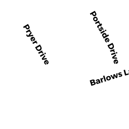
45 BARLOWS LANDING RD
Owner Information
PLANTE ERNEST A JR TR OF
11 WINDWARD STREET
MASHPEE, MA 02649-2865


Property Details
45 BARLOWS LANDING RD is classified as a Other Storage, Warehouse, and Distribution facilities (see also usecode 401) (Warehouse).
The primary structure on this property was built in 1968. There are 25,691ft2 of built area within this property. There is 25,691ft2 of residential/living space within this property.
45 BARLOWS LANDING RD is valued at $1,182,100. The land is valued at $740,300 and the structures are valued at $412,200. There is an additional valuation of $29,600 on this property.
The most recent deed for 45 BARLOWS LANDING RD is recorded at the local registrar in Book 10918, Page 156. 45 BARLOWS LANDING RD was last sold on Tuesday, August 26, 1997 for $415,000.
Assessment data from fiscal year 2020.
Flood Data
According to the FEMA National Flood Hazard Layer, this property does not appear to be in a flood zone. It may also be in an area not yet reviewed. Nonetheless, confirm this information prior to taking any action.
To view the flood hazards around this property, create a FEMA "Firmette" Map of the area around 45 BARLOWS LANDING RD.
Broadband Internet Providers
| Provider | Type | Bandwidth (mbps) | |
|---|---|---|---|
| VSAT Systems, LLC. | Satellite | 2 | 1 |
| HughesNet | Satellite | 25 | 3 |
| GCI Communication Corp. | Satellite | 0 | 0 |
| T-Mobile | Fixed Wireless | 25 | 3 |
| Comcast | Cable | 1000 | 35 |
| Verizon New England Inc. | DSL | 5 | 0 |
| Viasat Inc | Satellite | 35 | 3 |
Broadband service provider data from December 2020.
Adjacent Properties
- 41-1 BARLOWS LANDING RD
IMPUTED - Office Condo Bldg owned by 41A BARLOWS LANDING ROAD LLC - 41-2 BARLOWS LANDING RD
IMPUTED - Office Condo Bldg owned by 41A BARLOWS LANDING ROAD - 41-3 BARLOWS LANDING RD
IMPUTED - Office Condo Bldg owned by MELCHIONDA MARISSA TRS - 41-4 BARLOWS LANDING RD
IMPUTED - Office Condo Bldg owned by DENMARK MARISSA TRUSTEE - 41-5 BARLOWS LANDING RD
IMPUTED - Office Condo Bldg owned by LACERTE GHISLAINE C - 41-6 BARLOWS LANDING RD
IMPUTED - Office Condo Bldg owned by LACERTE GHISLAINE C - 41 BARLOWS LANDING RD
IMPUTED - Office Condo Bldg owned by KELLEY MICHAEL D TR - 61 BARLOWS LANDING RD
Developable Commercial Land owned by 79 BARLOWS LANDING ROAD LLC - 0 BARLOWS LANDING RD
Undevelopable Residential Land owned by MEDEIROS PAUL J TR - 1 KYLE DR
Other Storage, Warehouse, and Distribution facilities (see also usecode 401) owned by HEATHERWOODS LLC